Fort Lytton, Fort Bribie, Robert Bulcock’s tower in Caloundra, Mt Ninderry – these were lookouts for foreign vessels at sea.
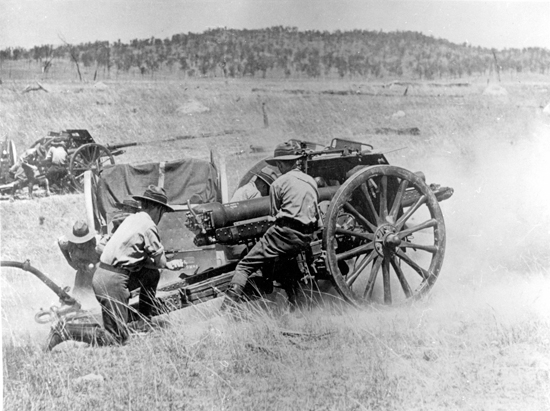
Fort Lytton and Fort Bribie had gun emplacements.
However, the guns were only ever fired for target practice.
Modern warfare involves attacks by air, sea, or land but in earlier times, attacks might have more likely come from the sea.
What is left of Fort Lytton and Fort Bribie forms a remarkable story of the first military defence for Queensland.
Fort Lytton on the Brisbane River was built as a major fortification in 1880–1881.
At that time, world colonial powers were expanding and it was believed that enemies of the British Empire may try to strike at the Port of Brisbane.
Russia or even France might have tried an illegal entry to the Brisbane River and, in a worst scenario, attack Brisbane.
For 40 years, Fort Lytton remained the centre of Queensland’s defence activity.
Before World War I, military training was conducted there by the Queensland Defence Force.
In World War II, additional weaponry was installed with the responsibility of keeping enemy vessels out of the river.
It became secondary to modern batteries established on Moreton and Bribie Islands.
In 1988 Fort Lytton became a national park.

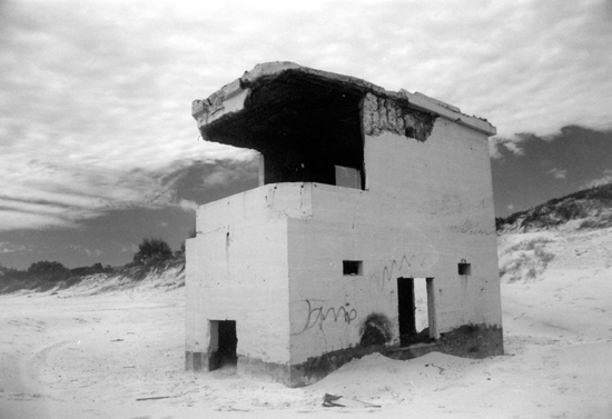
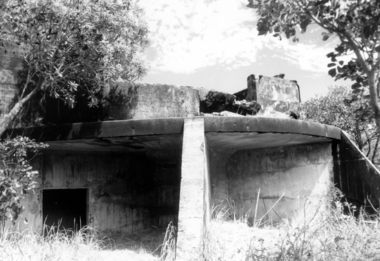
Fort Bribie, constructed in 1939 at the start of World War II, on Bribie Island was made up of about a dozen structures ranging from observation posts, mine control huts to gun emplacements.
Men worked in underground concrete bunkers to co-ordinate guns and searchlights on a target.
Fort Bribie was well placed to watch over the main north-west shipping channel into Brisbane.
The same shipping channel used by today’s large container ships was the one under scrutiny in World War II.
In 2022, the buildings of Fort Bribie have been battered by sea and tides and barely stand upright.
These large concrete structures are all but swallowed up by the sand.
Love nostalgia? So do we. Help keep more great Coast memories alive by subscribing to our free daily news feed. Go to Subscribe at the top of this story and add your name and email. It’s that simple.

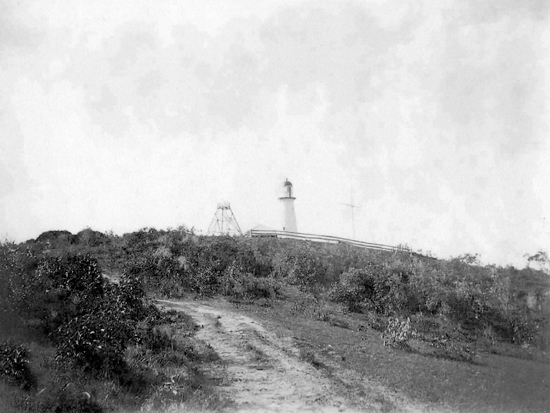
At Caloundra, in 1881, patriot Robert Bulcock built a timber observation tower on the highest part of his land and this was considered a vital surveillance point to view the approach of any foreign or hostile vessel.
Volunteers manned the tower and a direct link by telegraph to the government was established if needed.
This site was used for the Caloundra Lighthouse in 1896.
During World War II, the swamps and bushland in the Currimundi area and the back of Peregian were remote areas without population which were used for army target practice.

The name Battery Hill in Caloundra survives as a reminder of those times.
Mt Ninderry was the highest point along the coast for the local Volunteer Defence Corps to man a look-out for the coast line.
It was believed that in World War II Japanese forces might have tried to land on the coast and come inland destroying road and rail links and disrupting the war effort.
At that time trains carried troops and equipment to the far north of Queensland.
Visitors can access the remains of fortifications at both Fort Lytton and Fort Bribie and hear the stories of the buildings and their functions.


