
Noosa is set to become the first Queensland council to use new interactive 3D hazard mapping technology, which will educate residents on how disaster events could impact them.
At a series of sessions to be announced soon, residents will be able to see exactly how a bushfire might unfold in their immediate streets and neighbourhoods.
“Our aim is to educate residents on the risks bushfires pose to their immediate neighbourhoods to encourage locals to be prepared,” Noosa Mayor Clare Stewart said.
“Knowing what you may face, and the best way to respond – before disaster strikes – will help keep you safe when the time comes.”
The technology, known as a Simtable, uses a projector to overlay hazard projections over local mapping and terrain in 3D. The system models fire behaviour based on geophysical and meteorological conditions to demonstrate how fire might move through the landscape, and what impact it may have on the built environment.
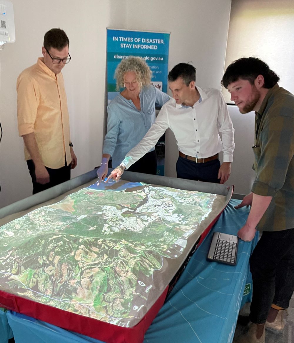
Kur-ring-gai Council in New South Wales, an early adopter of the technology, uses its Simtable as part of its Climate Wise Communities (CWC) workshop program to increase community engagement.
Staff from Ku-ring-gai Council, the Canberra Region Joint Organisation and Hunter Joint Organisation visited Peregian Digital Hub recently to train with Noosa staff in the use of the technology.
Noosa Council’s Local Disaster Coordinator, Larry Sengstock, said Noosa was pleased to be the first Queensland council to adopt the new product.
“In addition to its educational value, we look forward to exploring how this technology might support disaster management by predicting how actual fires and floods play out so we can better manage them as they unfold,” Mr Sengstock said.
Mayor Stewart said the new tech was part of Council’s ongoing effort to reduce the shire’s bushfire risk and make the community more resilient.
“We’ve invested significantly in measures aimed at preventing a repeat of the 2019 fires, including more controlled burns, greater trail maintenance and appointment of an in-house officer to oversee local hazard reduction efforts,” she said.
“Education is vital to making sure we’re disaster resilient so I’d encourage residents to attend the community sessions once finalised so you can get to know your own risk, which will help inform household emergency plans.”
Council funded the Simtable technology with support from the Federal Government’s Black Summer Bushfire Grants and the 2019 Cat C Bushfire Fund.
Disaster Management Officer, James Ulyate, said Get Ready Month – on now – was a great time to make household emergency plans, pack an emergency kit and update insurance.
“Consider where you’ll go if you need to evacuate or can’t get home, and if you do need to evacuate your home, what will you take if you have to leave in a hurry?”
For help developing your plan, visit getready.qld.gov.au/plan
Do you have an opinion to share? Submit a Letter to the Editor with your name and suburb at Sunshine Coast News via: news@sunshinecoastnews.com.au
SUBSCRIBE here now for our FREE news feed, direct to your inbox daily!
