
The Sunshine Coast could face some wild weather in coming days, with a possible cyclone off the coast.
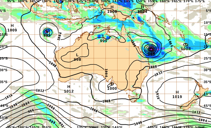
A low in the Coral Sea was expected to intensify and potentially turn into a tropical cyclone by Wednesday night or Thursday.
Bureau of Meteorology meteorologist Livio Regano said the Sunshine Coast could be confronted with some windy conditions.
“Its most likely track will be parallel to the coast, and it will probably reach its closest point to the Sunshine Coast on late Thursday or Friday, before it moves towards New Zealand,” he said.
“So, temperatures will drop, it will get cloudier and windier.
“If we’re unlucky we may have to endure a gale warning but, at this stage, we probably won’t go past a strong wind warning of up to 30 knots.”
He expected the beaches to cop a battering.
“Just having a low, let alone a cyclone, come that close is going to throw up a decent swell,” he said.
“It’s expected to substantially rise coming into Friday and Saturday.”
The powerful surf and wind could further erode several stretches of beach, which have already been exposed to recent strong tides this year.
A high tide of about 2m was expected on Friday.
Mr Regano stressed that cyclone tracking can be erratic and he urged locals to stay up to date with the latest advice.
Large swell
A low or cyclone off the Sunshine Coast would generate big and powerful surf.
Renowned surfer and lifeguard Shane Bevan expected 3m to 4m waves.
“We’re probably going to cop the really strong part of the front on Friday and maybe Saturday,” he said.
“The strength of a system that close to the shoreline, about 200km to 300km away, creates really strong water movement and huge waves.
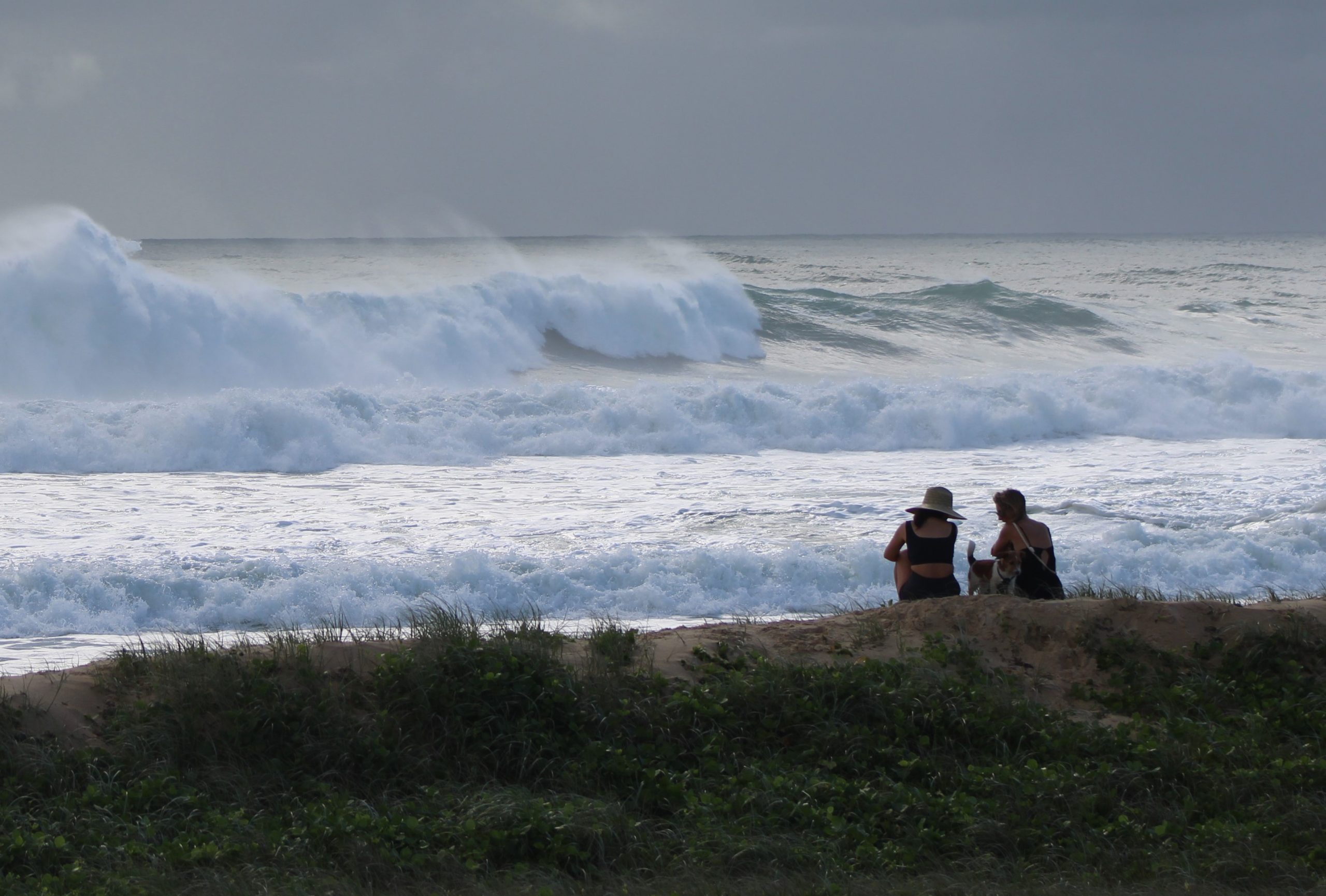
“You probably won’t be able to surf it initially because it will be messy. The wind will cause it to be onshore.
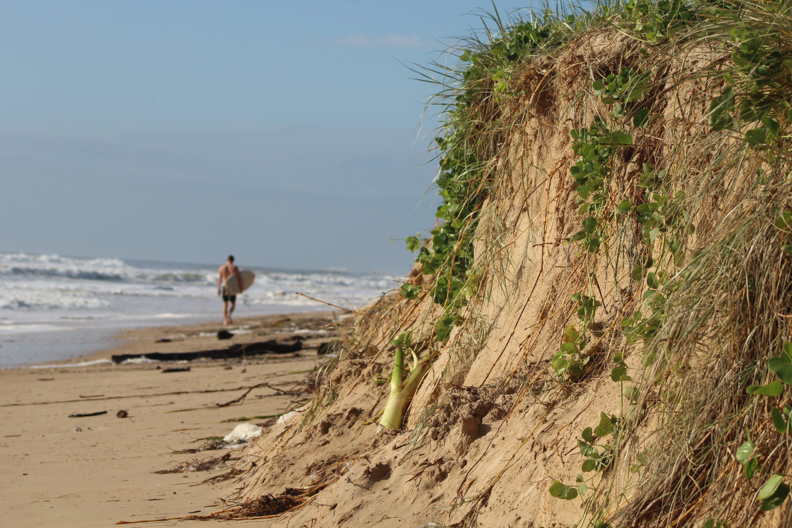
“But the quality could be better by Sunday, when the system could go towards New Zealand and winds would move offshore.”
He said the surf should be a cleaner 3m to 4m then and experienced surfers could make the most of the conditions at point breaks like Point Cartwright, Moffats and Noosa.
Mr Bevan, a lifeguard at Alexandra Headland, urged beachgoers to be wary.
He said swimming was not an option.
“It’s so dangerous,” he said. “It’s not worth it.
“Beaches will probably be closed on Saturday and maybe on Sunday.
“It’s definitely too dangerous to swim when there are big seas and big rips (associated) with cyclones.”
Mr Bevan also stressed that weather systems were unpredictable and the system could steer clear of Sunshine Coast waters or even cross the coast further north.
Passage opportunity
An offshore low or cyclone has the potential to significantly change the conditions within the Pumicestone Passage.
A tidal breakthrough at Bribie Island, associated with the previous offshore cyclone 13 months ago, created large, shifting sand banks that blocked parts of the waterway on low tide.
Caloundra Coast Guard commander Roger Pearce said another significant system could clear the passage this time, especially at a major sand bar that started to split on high tide recently.
“If we get a storm surge on top of a high tide, that could annihilate it (the large sand bar),” he said.
“That would break it up, and boaties would be able to head north to Caloundra or south to Lamerough Canal (at low and high tide).”
He said the opening that developed in the spit just over a week ago was now about 50m wide and 60cm deep at low tide.
Coast Guard can now get their large boat through the gap, after being largely restricted for the past year.
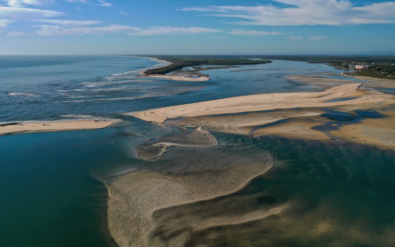
Mr Pearce also said a storm surge and high tide could make an impact on the Caloundra bar, which has silted up dramatically during the past year.
“It’s possible it will (break up),” he said.
“It (the sand bar) is now 100m to 200m across and there is a big basin, so it’s very exposed and it has very soft sand, so it could well open.
“Or it could close completely, with sand above the high-water mark.
“We will wait and see.”
Do you have an opinion to share? Submit a Letter to the Editor with your name and suburb at Sunshine Coast News via: news@sunshinecoastnews.com.au
