
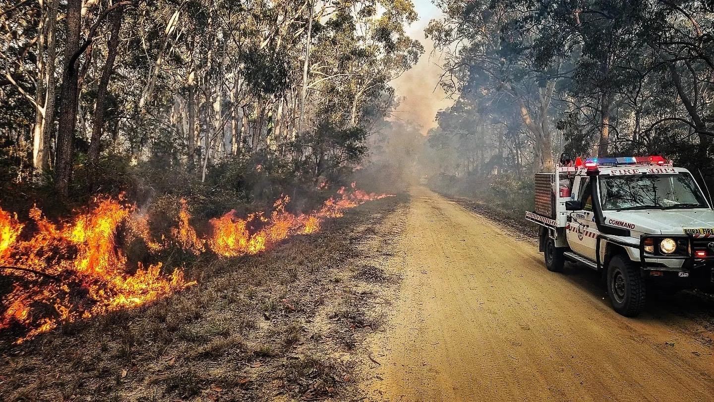
Weather experts are urging Sunshine Coast residents to brace for increased threats from heatwaves and bushfires for months to come, after a blaze tore through 200 hectares of national park last week.
Hotter and drier conditions are expected in the region, following the formal declaration of El Nino last week, when people near Beerwah were urged to leave the area because of a large fire.
The Bureau of Meteorology’s long range forecast indicated the Sunshine Coast was very likely to receive above median maximum and minimum temperatures during the rest of spring and into the start of summer. The region was also likely to very likely to see below median rainfall.
BOM Senior Climatologist Hugh McDowell urged locals to be ready for abnormally high temperatures.
“We should be aware of the risk of heatwaves,” he said.
“Heatwaves are Australia’s most deadly hazard and this forecast brings an increased risk of them in the upcoming hot season.”
He also said residents should be on guard for bushfires that could pose threats to homes, industry and agriculture.
Homeowners in the hinterland have already had to evacuate after a serious fire, which was tackled by multiple crews, 60 vehicles and six aircraft at its peak.
“The Sunshine Coast has roughly 1.5 times the normal chance of seeing unusually dry conditions (in coming months),” Mr McDowell told Sunshine Coast News.
“We should be aware of the increased risk of bushfire this season as shown by the AFAC (Australasian Fire And Emergency Services Authorities Council) spring outlook which takes into account the bureau’s long-range forecast.”
“And while there is a drier forecast this does not preclude the chance of severe storms and flash flooding.”
He said locals should get ready now, in case of emergencies.
“It is important to have a bushfire, heatwave and severe storm/flooding plan in place.”
“These can all be prepared with advice from local emergency services.”
Most of eastern Australia is set to be affected by the first El Nino in eight years. There were a number of heatwaves and bushfires across the country in 2015.

University of Sunshine Coast Senior Lecturer in Geotechnical Engineering, Dr Adrian McCallum, explained the phenomenon and urged Sunshine Coasters to be vigilant.
“El Nino, which means ‘Little Boy’ in Spanish is the term used to describe the phenomenon when south-east trade winds weaken, enabling warm pacific water to flow back eastwards, suppressing upwelling of cold water off the west coast of South America,” he said.
“For Australia, this typically means drier conditions, because heavy rainfall that usually occurs to the north of Australia moves to the central and eastern parts of the Pacific basin.
“Surface pressure also decreases, consistent with less convection and thus rainfall.
“With less local convection, there’ll be less clouds and less rainfall, probably resulting in warmer than average temperatures and dryer conditions – this of course could result in dryer vegetation and greater bushfire potential.”
El Nino conditions typically last for between six months and two years.
“Those on tank water need to think about consumption and whether they might need to arrange top-ups,” Dr McCallum said.
“The rest of us need to heed bushfire warnings and ideally have a bushfire plan in place.”
The National Emergency Management Agency encouraged Australians to be prepared during the Higher Risk Weather Season (October to April).
“Due to higher than usual levels of rainfall over the past 18 months, increased fuel load, and drier weather anticipated for the months ahead, we must prepare for the elevated risk of grass and bushfires, as well as possible heatwave conditions,” they said in a media release on Friday.
