
Heavy rain has lashed the Sunshine Coast and flood warnings have been issued, as a persistent weather system moved in.
Some parts of the region recorded more than 240mm in 31 hours, as south-east Queensland and northern New South Wales copped torrential falls.
And the Bureau of Meteorology warned that heavy rain and flooding could continue into Wednesday morning, especially on the Sunshine Coast.
“This weather system will see the focus of it shift towards Brisbane and upwards towards the Sunshine Coast over the course of today,” meteorologist David Grant said on Tuesday.
“And with that, that’s where we’re probably going to see our primary flood risk during the course of today, into tonight and potentially even into early parts of Wednesday morning.”
⚠️🌧️Severe Weather Warning for HEAVY to LOCALLY INTENSE RAINFALL with a risk of FLASH FLOODING continues in #SEQld for areas north of Brisbane, especially around the #SunshineCoast region. The risk has now eased for #GoldCoast & #ScenicRim regions. https://t.co/HhFPSpQmgD pic.twitter.com/2K04y0C0tC
— Bureau of Meteorology, Queensland (@BOM_Qld) January 2, 2024
“This situation continues to be dangerous and dynamic,” meteorologist Miriam Bradbury said after much of the south-east was swept with rain on Monday.
On the Sunshine Coast, the airport received 191mm from 9am Monday to 4pm Tuesday, while Caloundra (Sugar Bag Road) had 246mm, Tewantin had 144mm and Nambour had 139mm.
Several other stations recorded well in excess of 100mm.
Do you have an opinion to share? Submit a Letter to the Editor at Sunshine Coast News via news@sunshinecoastnews.com.au. You must include your name and suburb.
A flood warning issued for parts of the region was updated at 3.48pm on Tuesday.
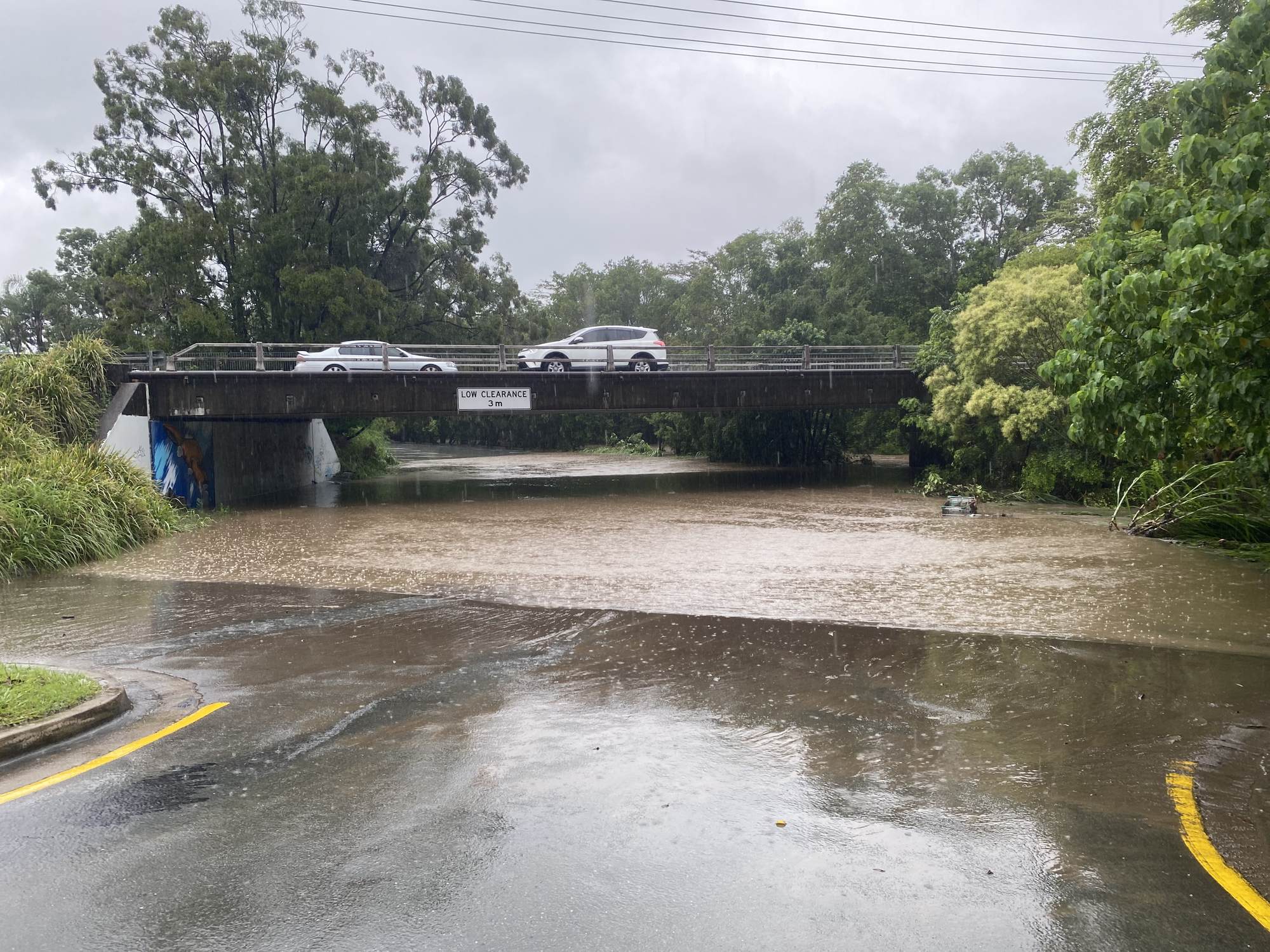
The Mooloolah River at Palmview was at 2.72m and rising, below the minor flood level (4.5m). It is likely to exceed the minor flood level (4.5m) on Tuesday evening, and further rises to the moderate flood level (4.6m) are possible with further rainfall.
Moderate flooding may occur along the Mooloolah River. The Mooloolah River at Palmview is currently at 3.16m and rising, below the minor flood level (4.50m). The Mooloolah River at Palmview is likely to exceed the minor flood level (4.50m) Tuesday evening. Further rises to the moderate flood level (4.6m) are possible with further rainfall.
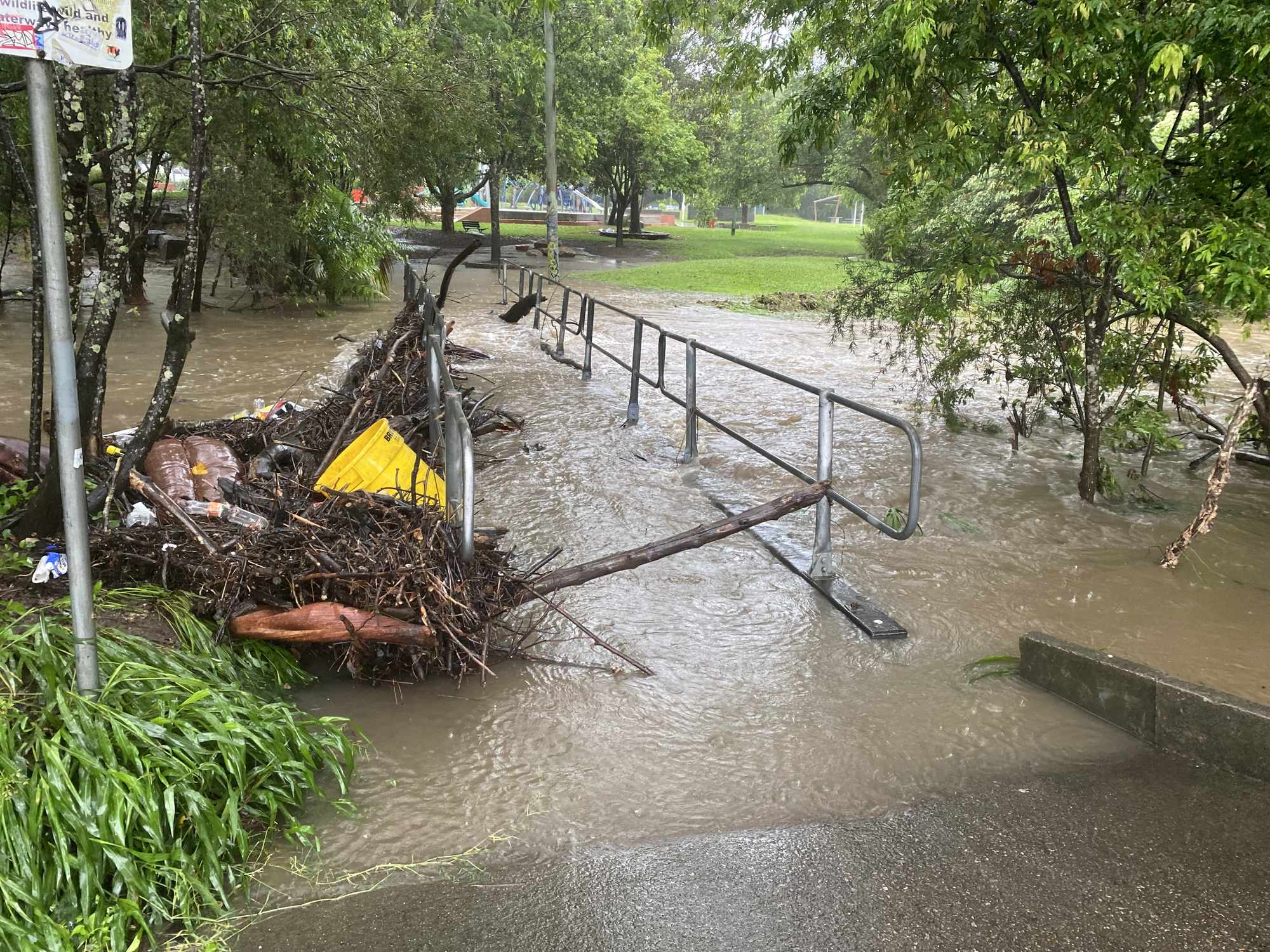
Some roads and car parks have been impacted, including Nicklin Way at Aroona, Crosby Hill Road and Walgarri Drive at Tanawha, Eudlo Road at Mooloolah Valley and at Old Maroochydore Road at Forest Glen. The popular Lions Park carpark in the heart of Noosa Heads has been closed.
A recent severe weather warning, issued at 2.34pm, said a humid easterly airflow is feeding into a coastal trough near the south-east Queensland coast. This is combining with a strong upper-level trough to produce heavy shower and thunderstorm activity.
It said heavy rainfall which may lead to flash flooding is occurring over parts of the south-east Queensland coast and far southeastern Wide Bay and Burnett area on Tuesday. Isolated three to six-hourly rainfall totals between 100mm and 200 mm are likely, with isolated 24-hourly totals approaching 350 mm possible.
There remains some uncertainty in the movement and timing of features, but the heavy rainfall risk is expected to gradually later on Tuesday afternoon or evening.
Heavy rainfall increases the potential for landslides and debris across roads.
A general flood watch is also current for areas in South-East Queensland, including the Mary River, Noosa River and Sunshine Coast rivers and creeks.
The Gold Coast was saturated on Monday, with Currumbin Creek receiving 571mm of rainfall in 24 hours, Upper Springbrook 350mm, Mount Tamborine 161mm and Pimpama more than 375mm.
Limpinwood in NSW received 307mm of rain in the 24 hours to 9am on Monday, Numinbah 297mm, Coffs Harbour Airport 205mm and Sawtell 190mm.
“Our waterways and infrastructure aren’t built to withstand such a large amount of rain over such a short period,” Ms Bradbury said.
Rescuers responded to at least 115 incidents in 24 hours triggered by storms and flooding in northern NSW.
Crews had completed 27 rescues in the Northern Rivers region alone since Monday although no significant injuries had been reported, the NSW State Emergency Service said.
And the Australian Defence Force will be sent into South-East Queensland to help with recovery following storms and heavy rain. Federal Emergency Management Minister Murray Watt said 50 ADF personnel will head to the Gold Coast, Scenic Rim and Logan from Thursday.
