
A key highway interchange is about to undergo significant changes as part of a $105m project to improve travel between the Sunshine Coast and Brisbane.
The new traffic arrangement at the Bruce Highway southbound entry ramp from Caboolture-Bribie Island Road will be operational in early 2024.
The changes are being delivered as part of the Bruce Highway – Pine River to Caloundra Road Smart Motorways Stage 2 (SMS2) project.
Related story: Huge highway upgrade on road to completion
Powered by Smart Motorways technology, signals will be activated to open four traffic lanes on the ramp during high-demand periods or in response to incidents on the road network.
The addition of the two new outside lanes on the ramp will provide greater capacity to help manage traffic entering the highway. These lanes will be available for temporary use when the overhead sign is displaying a speed limit.
Once free-flowing conditions return, the temporary storage lanes will close and the overhead ramp signals will display a solid red cross. Motorists must not travel in a lane when a solid red cross is displayed overhead.
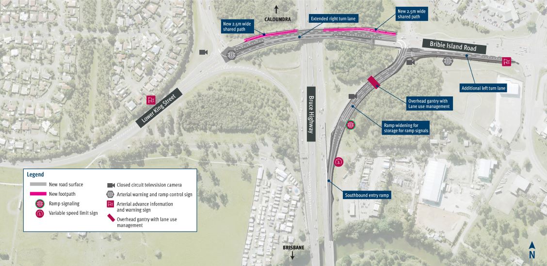
When the ramp signals are not in use, the ramp will revert to two-lane operations.
Department of Transport and Main Roads North Coast region program delivery and operations, infrastructure management and delivery regional director Scott Whitaker said the changes were aimed at reducing traffic congestion.
“Investing in smart technologies on the transport network will help to keep people and goods moving in a more efficient way,” he said.
“Stage 2 of the Smart Motorways project expands on the success of the previous roll-out of these important technologies between Uhlmann Road and the Pine River.
“With this busy 60km section of the Bruce Highway between the Pine River and Caloundra Road carrying thousands of road users daily, TMR are providing a safer and more reliable transport network for the many growing regions of Queensland.
“We urge everyone to drive to the changed traffic conditions as we go live with the new ramp arrangement and technology and road users familiarise themselves with these changes.”
Smart Motorways technologies include ramp signals, variable speed limit and message signs, vehicle-detection systems and CCTV.
Work on the SMS2 project started in 2022 and technology testing is underway at various locations from Pine River to Caloundra Road, with works expected to be completed in early 2024, weather and construction conditions permitting.
The $105m project is jointly funded, with the Australian Government contributing $84m and the Queensland Government contributing $21m. The investment is estimated to support an average of 140 direct jobs over the life of the project.
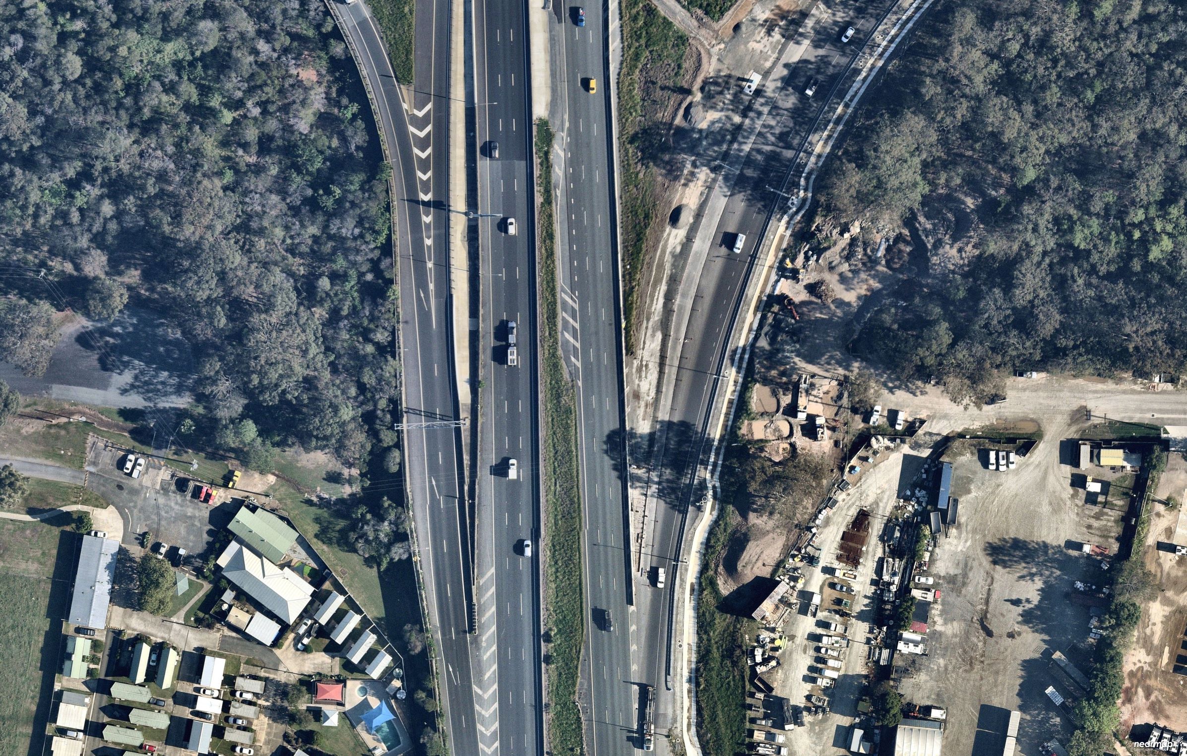
The aerial imagery in this story is from Australian location intelligence company Nearmap. The company provides government organisations, architectural, construction and engineering firms, and other companies with easy, instant access to high-resolution aerial imagery, city-scale 3D content, artificial intelligence data sets, and geospatial tools to assist with urban planning, monitoring and development projects in Australia, New Zealand and North America.
Help us deliver more news by registering for our FREE daily news feed. All it requires is your name and email at the bottom of this article.
