100% Locally Owned, Independent and Free

100% Locally Owned, Independent and Free

Northern Australia's big wet likely to continue as possible cyclone builds

Do you have a news tip? Click here to send to our news team.

Rare waterfront cafe site with units hits market

A riverfront property that’s home to a long-standing cafe as well as two attached residential units is on the market. The 506sqm site at 267 More

Carols event returns bursting with local talent

It's time to clear the Christmas ‘pipes’ and ready your voice for popular community Christmas carols in the park. Buderim Community Carols will once again More

B2B: Are annuities the retirement ‘secret’ you’ve overlooked?

Annuities have been around a long time. While they can sound complex, they are simply a way to convert potentially some of your super or More

$5m courthouse upgrade to help safeguard victims

A major safety overhaul is now locked in for the Maroochydore Courthouse, with $5 million of new funding guaranteeing long-planned domestic and family violence More

‘Game changing’ vehicle makes Coast debut

A “game changing” heavy-duty mid-size ute has just landed in Australia, with Sunshine Coast buyers among the first in the country able to see More

Developer plans 66-lot subdivision in fast-growing area

Plans for a residential subdivision with 66 lots in the Sunshine Coast hinterland have been submitted to Sunshine Coast Council for assessment. The proposal seeks More

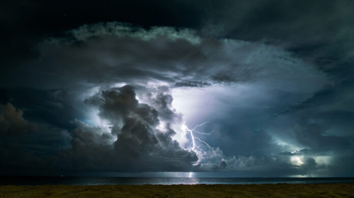
Queenslanders face the threat of another cyclone reaching their shores within days as intense rain continues across Australia’s north.

A tropical low building in the Coral Sea is expected to turn towards the coast from Sunday, with the system most likely becoming a tropical cyclone by Monday.

The Bureau of Meteorology says the system could strengthen to a category three or higher, possibly making a “severe impact” on the Queensland coast.

A bureau spokesman said on Thursday a cyclone could cross the state’s east coast from Tuesday but it was too early to predict where it would make landfall.

“The earliest possible is in the latter part of Tuesday but that’s not particularly likely,” he said.

“We’re looking beyond that to get a better idea of when it might actually affect the Queensland coast.”

The new danger coincides with a massive clean-up effort finally gaining momentum in the state’s far north after record flooding in December caused by Cyclone Jasper.

Meanwhile, a monsoon trough moving slowly over the Northern Territory was delivering damaging winds and heavy rain to Darwin on Thursday.

Warm, humid and stormy conditions are likely across large tracts of Queensland and northeastern NSW on Thursday, with severe storms delivering heavy rain, damaging winds and potential flash flooding.

Local journalists supporting local people. Help keep independent and fair Sunshine Coast news coming by subscribing to our FREE daily news feed. All it requires is your name and email at the bottom of this article.

Subscribe to SCN’s free daily news email

This field is for validation purposes and should be left unchanged.
This field is hidden when viewing the form
[scn_go_back_button] Return Home
Share