
A walking network plan has been greeted as a step in the right direction by a community group that has campaigned for footpath improvements in a hinterland town.
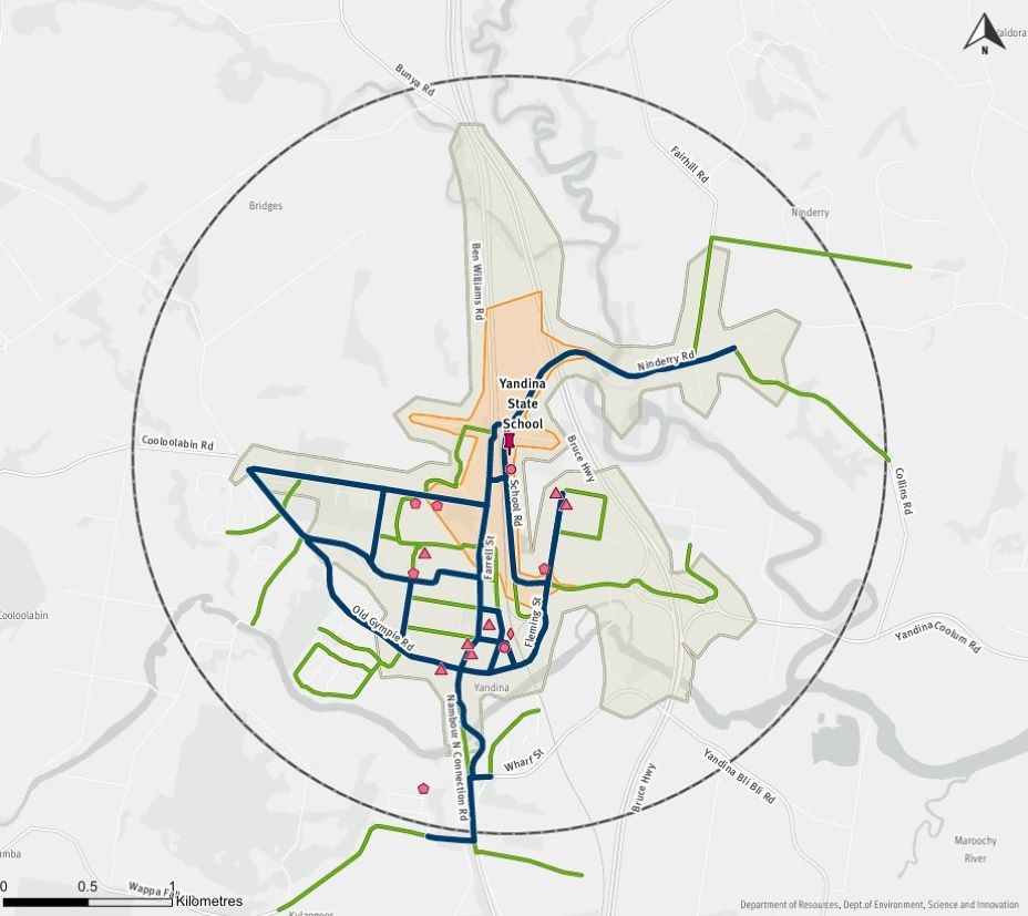
The Yandina State School Walking Network Plan, compiled by the Department of Transport and Main Roads and the Sunshine Coast Council, has recently been uploaded onto TMR’s website.
Yandina is now one of seven towns and localities on the Sunshine Coast that have walking network plans to provide a framework for improving the connectivity and accessibility of walking routes.
Yandina and District Community Association president Marie Reeve said many people were unaware of the plan and what it could mean in terms of providing safe, accessible paths in Yandina, which, as one of the older towns the Coast, still has many grassed footpaths.
“I just think that it’s such a massive undertaking that they’re not alerting a little community to the fact that they’ve now got a walking plan, but the little community likes to know these things,” she said.
Ms Reeve said the plan would give the council a basis upon which to apply for funding for upgrading active transport infrastructure in town.
Ms Reeve said local councillor David Law had appreciated the need for improved pathways in Yandina but it had been difficult for him to secure funding for improvements.
“He’s very delighted we’ve got this walking network plan, that it’s now going to be something that can be used to get funding,” she said.
Cr Law welcomed the walking network plan.
“I am pleased with the walking network plan that builds on the work of council, YADCA, the school P&C, other community organisations and Sidelines Traffic (consultancy),” he said.
“I will continue to improve the footpath connectivity throughout Yandina,” he said.
YADCA raised the issue of the state of Yandina’s footpaths in 2022 after a boy had a fall from a bike on a slim, uneven piece of roadside.
Yandina State School’s P&C Association has also advocated strongly for better paths for the safety of children walking to and from school.
Local journalists supporting local people. Help keep independent and fair Sunshine Coast news coming by subscribing to our FREE daily news feed. All it requires is your email at the bottom of this article.
YADCA encouraged locals to participate in active transport surveys and has continued to press for improvements, compiling a submission that went to the last Transport Minister, Bart Mellish.
“Okay, there’s a bigger population down the coast but our town isn’t the wilderness,” Ms Reeve said.
“There are people in the town who can’t walk because the ground’s uneven, they’re forced on the road – we’ve got a number of people with mobility problems, people in wheelchairs, people pushing prams.
“When you see them on Stevens Street because the ground is uneven, we definitely need better paths.”
She believed an active transport improvements plan prepared by Sidelines Traffic on behalf of the Council had been instrumental in triggering the walking network plan.
Ms Reeve also thanked Damian James, of Eumundi, a member of the Active Transport Advisory Board, for his support for better active transport routes in town.
She said current Transport Minister Brent Mickelberg advised that the council would be able to apply for 50:50 matched funding from TMR’s Walking Local Government Grants program for upgrades.
Ms Reeve said YADCA would be looking to ensure any money was well spent.
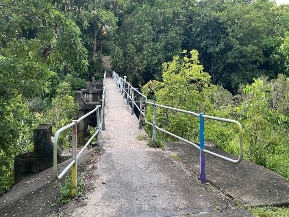
She said there were some concerns about a route across an existing footbridge over the Maroochy River east of the James Low Bridge, linking to a crossing south of the bridge.
The gradient from the footbridge to the roadside was thought to be too steep and there was demand for a pedestrian route on the western side of the James Low Bridge, she said.
“Pople do walk that bridge and take their life in their hands. A lot of people walk that bridge to go to town,” she said.
“Crossing the road can be an issue, especially at peak times.
“That road has a lot of traffic, especially a lot of trucks. The industrial estate has a lot of trucks in that area.
“The solution would be to have a bridge to the west of the James Low Bridge and link it with a path that goes up to the shops.”
Ms Reeve said improvements that had already been carried out in the town to improve safety included the Coulson Road pathway from Fleming Street to School Road, and a reduction in the Steggalls Road speed limit from 70km/h to 60km/h.
A Farrell Street pathway and a pathway along the length of Buckle Street were funded for this financial year, and applications had been made for grants for a Ninderry Road pathway upgrade from School Road to Farrell Street.
