
Tropical Cyclone Alfred is bearing down on South-East Queensland, where communities are preparing for its arrival within days.
The Category 2 system, which was tracking south, took a right-hand turn on Tuesday and was headed straight for the coast.
A cyclone warning was issued early on Wednesday for between Double Island Point to Grafton.
Police have been door-knocking homes in low-lying areas of the Sunshine Coast, warning residents of the triple threat of wind, rain and a storm surge that could coincide with a 1.71m high tide.
Police Superintendent Craig Hawkins said the cyclone should pack “quite a punch”.
“It will come with wind and rain and a storm surge,” he said.
For more local news videos SUBSCRIBE to our YouTube channel. Just click here.
“We are urging people, particularly in those low-lying areas, to get ready and understand the risks.
“We’ll start to get winds associated with the cyclone on Thursday morning and by that stage I would hope people have made the necessary arrangements.”
More than 40,000 sandbags have already been distributed to residents on the Sunshine Coast by the SES, and there were more on the way.
The centre of the cyclone is expected to make landfall between the Sunshine Coast and the Gold Coast on Thursday night or Friday morning, after previous forecasts put Maroochydore in the firing line.
Bureau of Meteorology senior meteorologist Dean Narramore told Sunshine Coast News that areas near and to the south of the crossing point would be worst affected. But the Sunshine Coast should still be dealt a considerable hit.
“The majority of the Sunshine Coast is north (of the projected crossing point) but is still likely to see strong and gusty winds of 60-80kmh, gusting to 100kmh, and widespread rainfall of 100-200m that could lead to flash flooding, but probably the biggest concern is that (tidal) surge.
“We’re likely to see abnormally high tides (2-2.3m), especially on Thursday night, which could lead some pretty big coastal erosion and inundation of low-lying areas and beachside properties.”
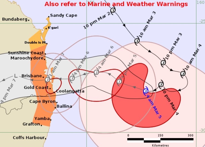
He said the cyclone’s ultimate crossing point was still uncertain and that the cyclone could “wobble” and head further north or south than anticipated.
Mr Narramore expected conditions to be relatively fine on Wednesday morning before the weather “amps up”.
“Showers and winds should start picking up in the afternoon,” he said.
“We’re likely to see rain and strong winds by Thursday morning and then the worst of the conditions should be on Thursday evening and through the night into Friday morning.
“Conditions should start easing on Friday afternoon and into Saturday.”
Mr Narramore said showers and storms, which could tend to rain, could persist through the weekend, but the winds “should drop off as soon as the cyclone crosses the coast, probably by the early afternoon on Friday”.
He said locals should “stay informed” and be prepared.
“Pay attention to council disaster websites to what’s required, like a battery-operated radio, water supply and food for a period.
“Bunker down while the event goes through.”
Temporary limits have been placed on the purchase of bulk water at Woolworths but Supt Hawkins urged people not to panic buy.
“There are no supply issues. There’s no need to panic buy,” he said.
“Buy what you need but be respectful of others who also need supplies.
“There is sufficient to go around.”
The Mooloolaba Triathlon, which attracts more than 5000 competitors, is being “rescheduled” and waves of 7.5m have been recorded at the Mooloolaba buoy.
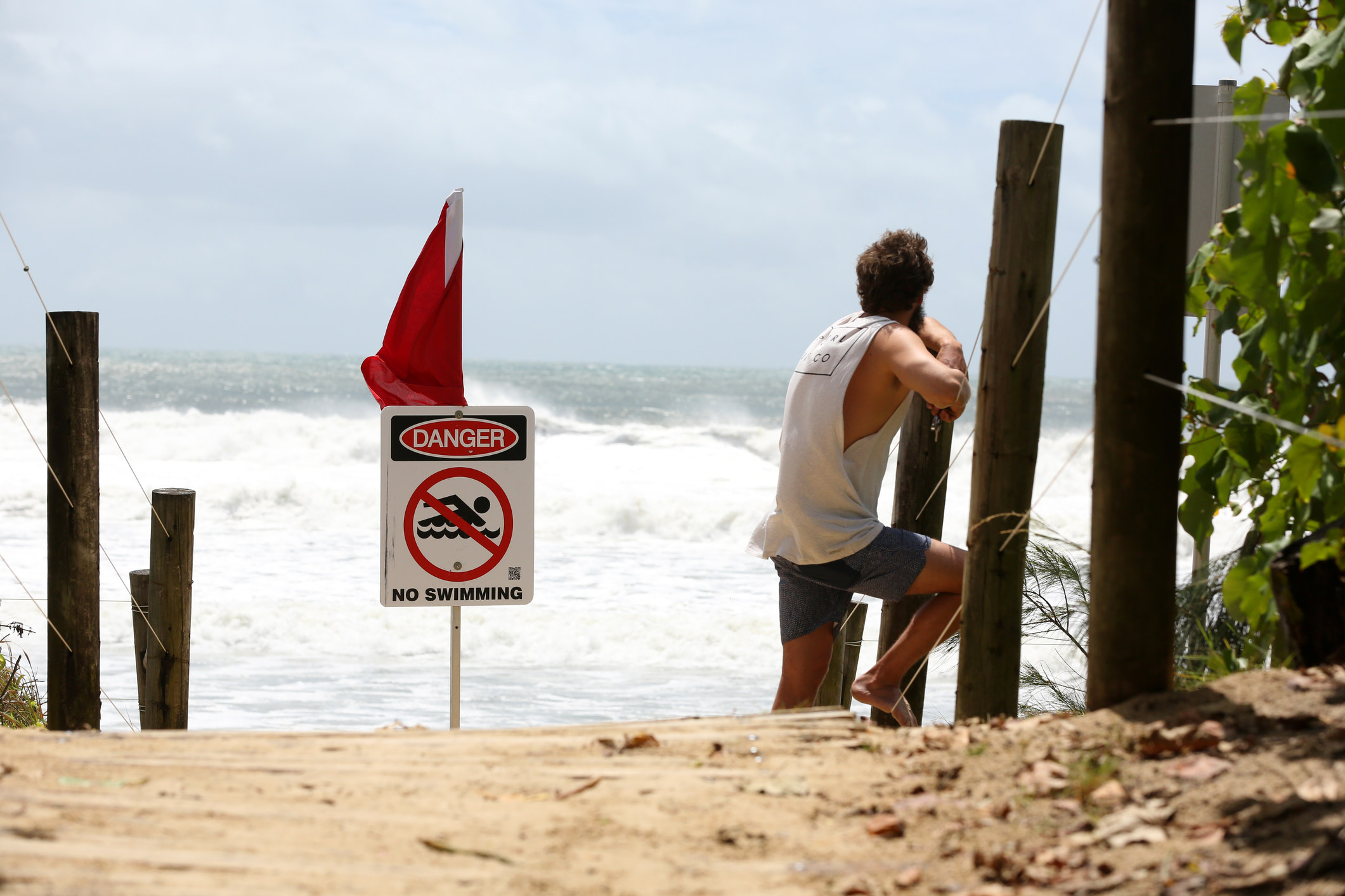
Some surfers have been making the most of the large swell but Supt Hawkins stressed that it was a risky pursuit.
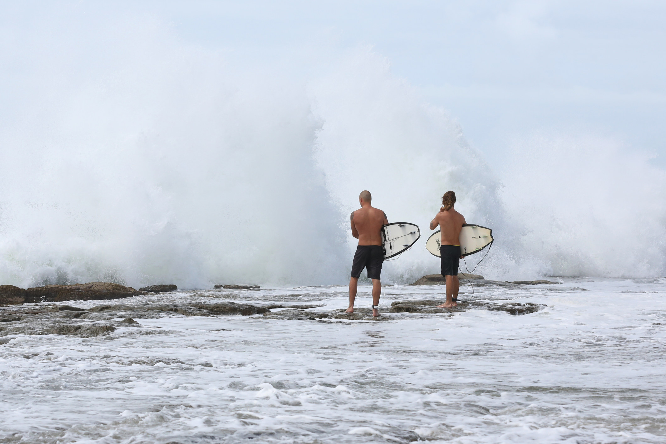
“We know there are surfers out there,” he said.
“We’re getting to the point where it is becoming very dangerous. To be out in the ocean is extremely risky. The beaches are closed and we hope people pay attention to the warnings.”
The cyclone could be the first in decades to make a considerable impact in the region.
Sunshine Coast mayor Rosanna Natoli said support systems were being put in place.
“Council’s disaster management team is working with our lead emergency agencies to prepare the region for the cyclone’s impact,” she said.
“We are currently finalising the locations of our refuge centres and will update our community as soon as we can.
“Please review our flood mapping on council’s website to understand the potential impacts on your property.”
Residential wheelie bins won’t be collected on Thursday or Friday in the Sunshine Coast and Noosa regions.
Federal MP Andrew Wallace, who provided SCN with a video of rough surf at Caloundra, also urged people to stay out of the water, get emergency plans in place and check on loved ones.
“The federal government stands ready and willing to provide assistance if required,” he said.
Temporary halts have been placed on purchasing an insurance police or amending an existing policy across much of the state’s south-east.
For passengers travelling to and from Sunshine Coast Airport over the coming days, Qantas, Jetstar Australia and Virgin Australia are offering customers with an opportunity to change flights or manage their bookings ahead of weather impacts.
For more information see getready.qld.gov.au, disaster.sunshinecoast.qld.gov.au and disaster.noosa.qld.gov.au.
