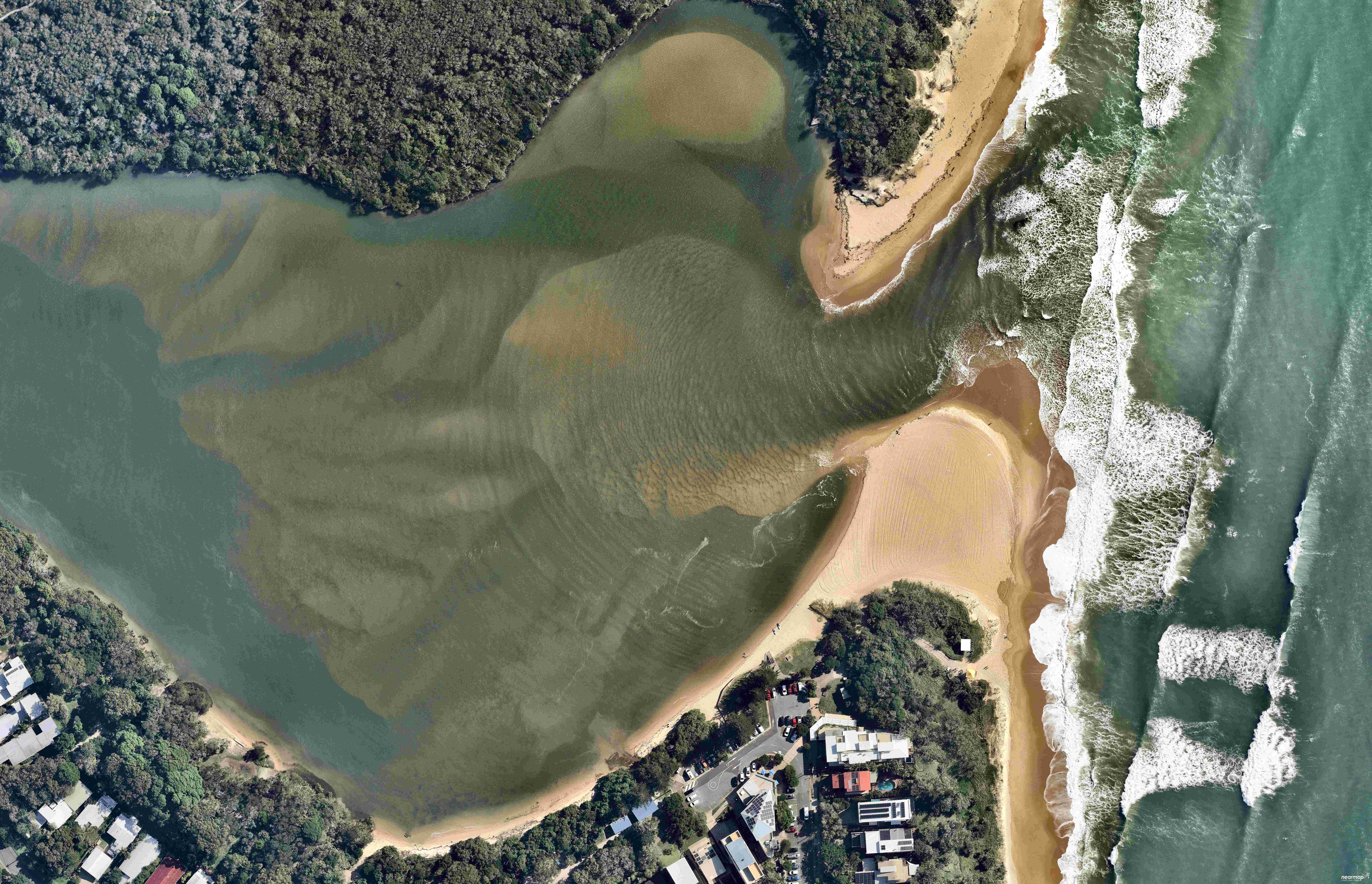
The Sunshine Coast’s shoreline is an integral part of the region’s identity and lifestyle, playing a huge part in luring more than four million visitors annually.
But the sands along the coastline are in a constant state of flux, because of both natural causes and human intervention, and can cause problems requiring costly repair jobs.
The Bribie breakthrough in particular has been a constant source of wonder since it opened in January last year, with the new bar becoming the dominant entrance to the Pumicestone Passage and the Caloundra Bar becoming a sand jam, causing concerns for water quality in the area.
To show how the coastline has changed, Sunshine Coast News has partnered with Australian location intelligence company Nearmap to bring readers a series of interactive photos. Simply drag the slider across the photos to compare the coastline in different years.
It is important to note some of the changes seen in the photos might be exaggerated by natural phenomena, particularly tidal movement.
Happy Valley, Caloundra: November 2021 to July 2023
Aerial imagery by Nearmap
Burgess Creek, Sunrise Beach: March 2019 to July 2023
Aerial imagery by Nearmap
Chambers Island, Maroochydore: April 2015 to July 2023
Aerial imagery by Nearmap
Currimundi Lake: March 2022 to July 2023
Aerial imagery by Nearmap
Golden Beach: November 2021 to July 2023
Aerial imagery by Nearmap
Mooloolah River mouth and La Balsa Park: April 2015 to July 2023
Aerial imagery by Nearmap
Maroochy River mouth: May 2017 to July 2023
Aerial imagery by Nearmap
Military Jetty, Lamerough Canal and Caloundra Power Boat Club, Golden Beach: July 2017 to July 2023
Aerial imagery by Nearmap
Noosa River mouth: June 2013 to July 2023
Aerial imagery by Nearmap
Stumers Creek, Coolum: May 2011 to July 2023
Aerial imagery by Nearmap
Tooway Creek, Moffat Beach: March 2022 to July 2023
Aerial imagery by Nearmap
Pincushion Island, Maroochy North Shore: April 2015 to July 2023
Aerial imagery by Nearmap
Related story: Interactive aerial imagery shows how Coast has changed
The aerial imagery in this story is from Australian location intelligence company Nearmap. The company provides government organisations, architectural, construction and engineering firms, and other companies, with easy, instant access to high-resolution aerial imagery, city-scale 3D content, artificial intelligence data sets, and geospatial tools to assist with urban planning, monitoring and development projects in Australia, New Zealand and North America.
Help us deliver more news by registering for our FREE daily news feed. All it requires is your name and email at the bottom of this article.


