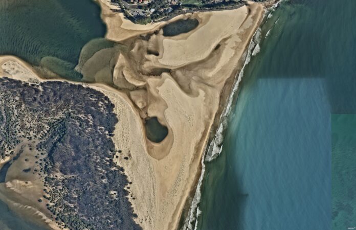
It’s been two years since the Pacific Ocean crashed through Bribie Island and set off a chain reaction of events in the northern reaches of the Pumicestone Passage.
The breakthrough, associated with heavy seas and wild weather, cut the island in two and dramatically altered its surrounds.
The area has been in a constant state of flux since as it changes with the ebb and flow of the ocean.
Water has rushed where it did not, and slowed where it once gushed. Sand has amassed in new spots and disappeared from others.
Scroll down for timelapse videos
Caloundra Coast Guard Roger Pearce said it was amazing to see the area transform in 24 months.
“It’s the most spectacular thing I’ve seen on the Coast, and it’s ended up with worldwide coverage,” he said.
“The biggest difference now is there’s a massive delta of sand coming out of the passage, going nearly 300m out to sea.”
He said the area was always changing.
“Every day,” he said, before adding that severe weather would have a major impact.
“All bets would be off,” he said. “We just don’t know what a big storm and swell would do to the sand.”
Check out the timelapse videos below, courtesy of images from Australian location intelligence company Nearmap.
The first video shows the northern end of the passage, including the Caloundra Bar and the emergence of the Bribie Island breakthrough. The second video focuses on the Caloundra Bar and the third video focuses on the breakthrough.
Please note, the images are intended to show the general nature of the environment changing. The images were taken at various times of day, so are likely affected by different tide levels.
The northern end of the Pumicesone Passage
Aerial imagery by Nearmap
The Caloundra Bar
Aerial imagery by Nearmap
The Bribie breakthrough
Aerial imagery by Nearmap
The aerial imagery in this story is from Australian location intelligence company Nearmap. The company provides government organisations, architectural, construction and engineering firms, and other companies, with easy, instant access to high-resolution aerial imagery, city-scale 3D content, artificial intelligence data sets, and geospatial tools to assist with urban planning, monitoring and development projects in Australia, New Zealand and North America.
Help us deliver more news by registering for our FREE daily news feed. All it requires is your name and email at the bottom of this article.


