Heavy rain and flooding is continuing across northern NSW as rivers swell and residents there endure another soggy day and face a huge clean-up.
The Bureau of Meteorology has issued a severe weather warning for heavy rain and abnormally high tides for parts of the northern rivers and mid-north coast.
Flooding is widespread around the northern rivers and evacuation orders remain in places north of Murwillumbah, Condong and Tumbulgum.
An evacuation warning remains for south Murwillumbah and also low lying areas north of Macksville, where minor flooding is occurring.
The order came after the Tweed River burst its banks near Tumbulgum on Tuesday, with minor to moderate flooding in the area.
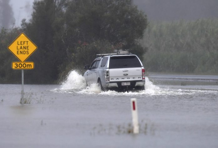
The SES says while rain is still around, roads will be flooded and the rivers are swollen.
There’s a risk of flash flooding when high tide occurs around 10am on Wednesday, with warnings for multiple rivers including the Richmond, Clarence, Wilsons, Bellingen, McLean and Hastings.
Minor flooding is possible along the Macleay River at Kempsey, as well as along the Camden Haven River at Laurieton. Meanwhile the Nambucca River at Bowraville has fallen below the minor flood level.
Flood waters have peaked at Glenreagh with moderate flooding. Moderate flooding is also occurring at Coutts Crossing with further rises expected.
The SES attended 85 jobs overnight and has performed 24 flood rescues since the extreme weather began on the weekend.
In total the SES has attended more than 1016 jobs.
“The majority of those jobs are fixing leaking roofs and damage due to heavy rainfall or trees down due to strong winds and we’re also getting requests for sandbags,” and SES spokeswoman said on Wednesday.
It has been a wild week of weather in NSW and Queensland.
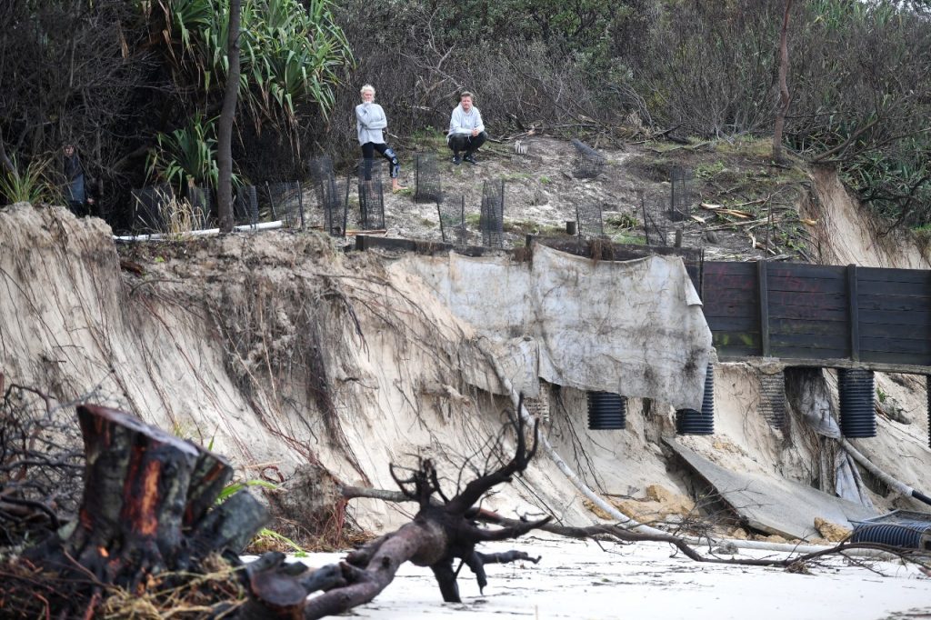
A low pressure system causing strong wind and heavy rainfall combined with king tides to wash away much of Byron Bay’s Main Beach on Monday.
On the Gold Coast the weather system also caused massive coastal erosion, with the surf club at Currumbin becoming an island.
The weather bureau said the worst of the wild event was over for the Coast, with wind dying down, surf improving and rainfall reducing.
However the Sunshine Coast could still expect short showers or thunderstorms each afternoon for the rest of the week and over the weekend.
The low-pressure system off the coast of southeast Queensland brought massive rainfall and gale-force winds, which combined with king tides on Sunday and Monday to gouge away many Sunshine Coast beaches.
The council is assessing the damage to popular beaches after sand cliffs were eroded into the dunes from Caloundra to Noosa.
The highest rainfall totals since Saturday were at Maleny 314mm, Sunshine Coast Airport 229mm, Crohamhurst 255mm, Wappa Dam 245mm and Landsborough 231mm.
Is local news important to you? Get it direct to your inbox by subscribing to our free daily news feed: Go to SUBSCRIBE at top of this article to register
Northern NSW continues to bear the brunt of the rain and associated flooding after much of Byron Bay’s Main Beach was washed away on Monday.

Some communities have been told they may have to evacuate because of flooding.
Flash flooding has closed roads and isolated small communities in northern NSW, with potentially 1000 properties affected.
The State Emergency Service has now issued a flood evacuation warning for south Murwillumbah, Tumbulgum and surrounding areas after the the Bureau of Meteorology predicted flooding for the Tweed River.
Heavy rain has continued overnight in the Tweed catchment and will continue.
NSW Premier Gladys Berejiklian said weather experts had warned La Nina would have an impact all over over Australia.
“So we need to expect the unexpected,” she told ABC TV.
“I’m hoping what we’ve seen in the last few days won’t be repeated frequently over summer, but it could.
“Our weather experts tell us we’re expecting conditions worse than what we’ve seen in quite a number of years.”


