
It’s usually mild, but this autumn will be wild and Australia’s most respected long-range forecaster has revealed why.
Hayden Walker, a fourth-generation forecaster and son of world-famous weather expert Lennox Walker, has prepared an exclusive analysis for Sunshine Coast News.
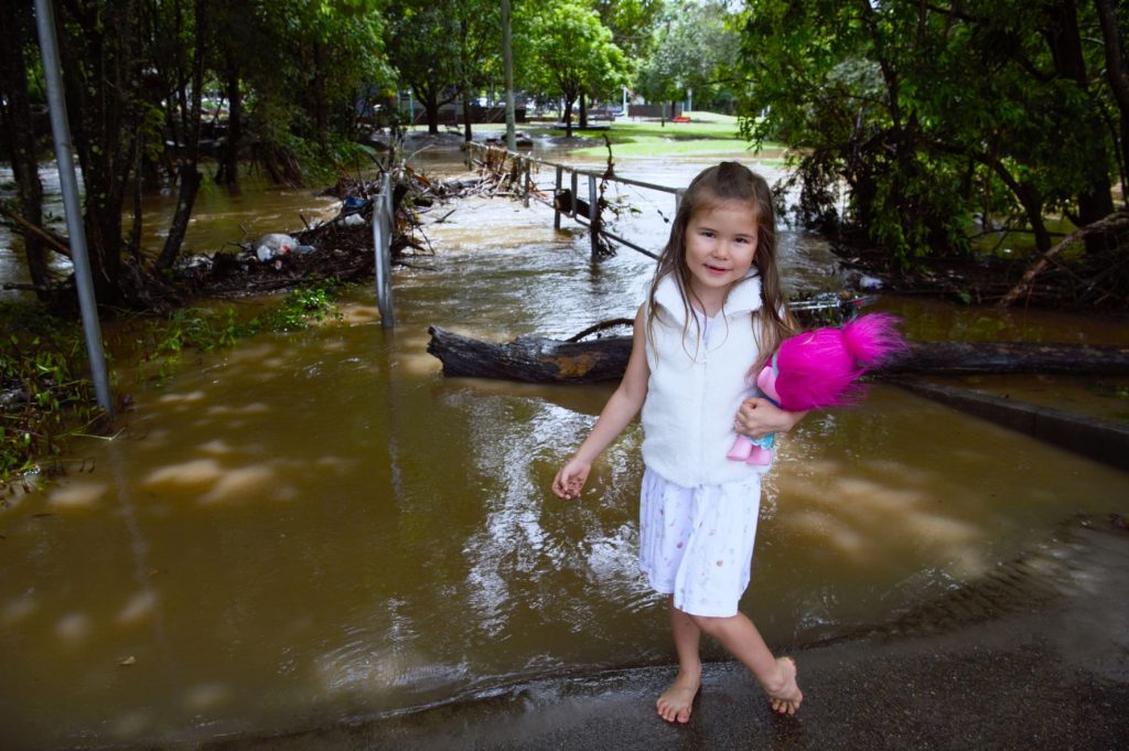
He is forecasting power-packed winds, large seas in April and a deluge leading to flooding in May.
“Two low pressure systems positioned in the Pacific Islands in April, and a cyclone near the Solomons in May, will instigate strong winds that will create wilder than usual conditions along the Queensland coast,” Mr Walker said.
Mr Walker’s report follows his highly accurate summer guide that predicted storms, heavy rain and flash flooding for southern Queensland and a windy February.
He said that strong south-easterly winds were indicated for the Sunshine Coast for the remainder of March, with scattered storms to continue.
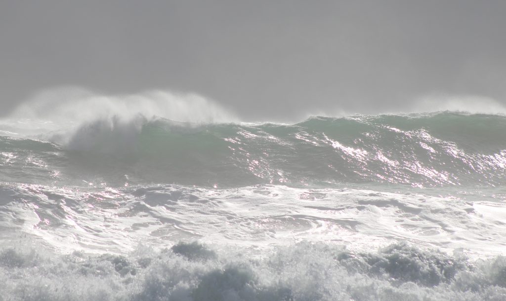
Mr Walker said April rainfall would be typical ‘April showers’, but there would be more action in the ocean with the possibility of erosion along the coastline.
“The Queensland coastline can expect strong winds and powerful swell from a low pressure system in the Pacific islands.
“During the second week of April, we will see storm activity in South-East Queensland with rain.”
Mr Walker said gale force winds – and more high seas – would be prominent during the latter half of April due to another low near New Caledonia.
“Isolated Thunderstorms are indicated for the Central Inland, South-East, Darling Downs and Port Curtis during the month. Mainly at the end of the month for the South-East,” he said.
Help keep independent and fair Sunshine Coast news coming by subscribing to our free daily news feed. All it requires is your name and email. See SUBSCRIBE at the top of this article
“Rainfall during May will be heavy in the South-East and Far North Coast during the first half of the month. Adjoining areas to the South-East, including border areas, will also be affected with flooding.
“Easterly winds are also indicated for the coastal regions during the month and will also be affected by a cyclone in the Solomons, generating strong to gale force winds.
“Towards the end of the month a cold front will pass through creating frosts to the Southern and Central Inland areas.
Thunderstorms are indicated to the South-East and Southern Interior during the first half May.
Elsewhere in the nation, Mr Walker predicts May will bring heavy falls to the eastern half of NSW.
“Most of Victoria, southern parts of SA and WA, and most of Tasmania will see heavy falls and there will be a late cyclone in the Northern Territory during the first half of April,” he said.
How it works:
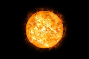
Hayden uses his knowledge of the sun, combined with patterns of sunspot activity and energy flow, to predict both the short and long-term future of weather worldwide, specialising in long range forecasts.
The sun has an everchanging surface which accommodates large sunspots emitting solar radiation or magnetic fields, which react with the Earth’s magnetic field.
This causes a reaction with the poles, thus producing Northern Lights. An increase in sunspot activity, especially during a Solar Maximum, gives rise to weather extremes, such as flooding, cyclones and storms.
The reverse happens during a Solar Minimum, or a dormant period, when we experience droughts.
Hayden has been successful in predicting many major weather events – such as the cyclones Larry, Yasi, Marcia and Olwyn, flooding to the NSW coast during April 2015 and recent storm activity in Queensland and NSW.
He was the only long-range weather forecaster to predict Cyclone Oswald that brought heavy rains to New South Wales and Queensland, especially the floods to Bundaberg.
INFORMATION: haydenwalkersweather.com.au
Get more stories like this direct to your inbox by subscribing to our FREE daily news feed: Go to SUBSCRIBE button at top of this article to register
